
Keyword
Earth Science | Oceans | Marine Sediments
95 record(s)
Type of resources
Topics
Keywords
Contact for the resource
Provided by
Years
Formats
Update frequencies
Status
draft
-
This record describes multibeam echosounder data collected on Bluefin voyage BF2018_V01, 'Hydrographic survey of the Petuna Aquaculture Sites in SW Bass Strait' which departed Stanley, Tasmania on the 27th June 2018 and returned to Beauty Point, Tasmania on the 4th July 2018. This survey was a part of a broader mapping campaign that involved a survey of the Boags Commonwealth Marine Reserve. The Kongsberg EM2040c multibeam echosounder was used to acquire seafloor bathymetry and backscatter information and watercolumn backscatter at the Boags Marine Reserve in the Bass Strait. The EM2040c provides a 1.3° by 1.3° transmit and receive angular resolution respectively. The echosounder's nominal frequency was 300 kHz and was operated in dual swath mode. Data are stored in *.all raw format for bathymetry and backscatter and *.wcd format for watercolumn backscatter at CSIRO. There are 269 files totalling 73.6 GB of raw .all data, and 269 files totalling 0.64Tb of raw .wcd in this combined campaign dataset. Sound velocity profiles were applied to this data during data acquisition. Bathymetry data contained in *.all format are corrected for motion and position. Tide corrections were not applied to the final processed dataset. Instead the data was mapped to the ellipsoid (GPS Height) and thereafter reduced to AHD (Australian Height Datum) using the AusGeoid09 model. Processed data has had outliers removed. Processed line data are available in *.gsf and ascii format, and processed bathymetry and backscatter grids in geotiff format. Additional information regarding this dataset, including further information on processing streams, is contained in the GSM data acquisition and processing reports. Additional data products may be available on request.
-

Sounding data extracted from: Continental Shelf Research 21 (2001) 157–201 Geochemistry and particle size of surface sediments of Exmouth Gulf, Northwest Shelf, Australia G.J. Brunskill,*, A.R. Orpin, I. Zagorskis, K.J. Woolfe, J. Ellison DOI: 10.1016/S0278-4343(00)00076-5 Project Details: The Pilbara Marine Conservation Partnership (PMCP) was an initiative designed to enhance the net conservation benefits of the globally-significant coral reef ecosystems of the Pilbara (Western Australia) by providing an assessment of the condition and trajectory of key ecological values. These assessments were designed to inform and complement existing governance and management arrangements and the PMCP is intended to provide ongoing advice and assessment for conservation efforts in the region, providing lasting benefits. The PMCP concept is based on three core ecological components, namely: Coral Reef Health - concentrating mainly on habitat forming primary producers. Fish and Sharks - their community structure, interactions and impacts on lower trophic levels. Environmental Pressures - physical and anthropogenic factors that influence the condition of reefs and associated biota.
-
Pilbara Marine Conservation Partnership (PMCP) coral reef sediment samples between northern Ningaloo and the Dampier Archipelago. The data include: * Sediment characteristics * Sediment particle size distribution from sediments sampled on reefs ---- The Pilbara Marine Conservation Partnership (PMCP) was an initiative designed to enhance the net conservation benefits of the globally-significant coral reef ecosystems of the Pilbara (Western Australia) by providing an assessment of the condition and trajectory of key ecological values. These assessments were designed to inform and complement existing governance and management arrangements and the PMCP is intended to provide ongoing advice and assessment for conservation efforts in the region, providing lasting benefits. The PMCP concept is based on three core ecological components, namely: Coral Reef Health - concentrating mainly on habitat forming primary producers. Fish and Sharks - their community structure, interactions and impacts on lower trophic levels. Environmental Pressures - physical and anthropogenic factors that influence the condition of reefs and associated biota.
-
In Western Australia (WA), the Environmental Impact Assessment process requires dredging proponents to make scientifically sound predictions of the likely extent, severity, and persistence of environmental impacts of the proposed activity under a spatially defined zoning pattern. This is achieved by using coupled hydrodynamic, wave and sediment transport models in conjunction with water quality (ecological) thresholds for sensitive receptors such as corals, filter feeders, or seagrasses/macroalgae. These predictions guide the scale and scope of associated monitoring programs, providing assistance to proponents as to where to establish environmental monitoring and reference sites. Increasingly, modelling is also being used by dredging programs to forecast a few days in advance, so as to understand the potential consequence of various dredging scenarios and optimize the dredging programs to minimize environmental damage. The overall objective of Project 2/3.4 was to improve the predictive capabilities of sediment dispersion modelling that incorporate dynamic plume and passive plume processes through assessing model sensitivity to key forcing and parameter values, such as met-ocean condition, particle settling velocity distribution, critical shear stress, sediment erosion and deposition, provide frequency and duration of biological stressor fields including suspended sediment concentration, sediment accretion and erosion, and available light; and provide guidance on developing best practice algorithms and parametrizations for dredge plume modelling. Based on the outcome Project 2/3.1, an appropriate modelling suite that includes hydrodynamics, waves, and sediment transport was chosen (Delft3D) to model the far-field passive plume. The model was set up and validated using the bathymetry and baseline data collected as part of the Chevron Australia Wheatstone Project, located near Onslow, Western Australia. The model outputs were assessed against monitoring data from Chevron Australia's Wheatstone Dredging program, including, remote sensing and in-situ data collected in Project 2/3.2. A 20 month hindcast of passive plume dispersal from the dredging project to the furthest extent of the passive plume were compared with the field data and MODIS images (where available). Spatial and temporal variability of plume dispersal under different forcing scenarios and sediment release rates were investigated and reported. This metadata record provides a description of the model input data (and where appropriate its location) and a short description of the software and model set-up. The simulation data files are located in the CSIRO DAP.
-
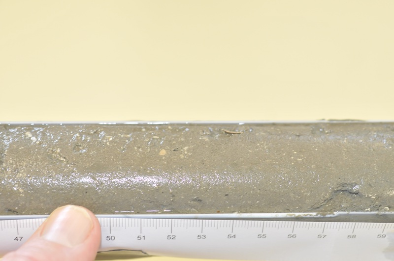
The remote Kimberley coast of north-western Australia is one of the few marine environments domains on earth largely unaffected by human use. However, the region is undergoing increasing economic importance as a destination for tourism and significant coastal developments associated with oil and gas exploration. The objective of the project was to reconstruct a timeline of inferred water quality changes from the sediment record for a selected set of sites in the Kimberley, Western Australia. The project made use of palaeoecological approaches to reconstruct a chronology of change over the last approximately 100 years using a series of biogeochemical proxies for phytoplankton composition and biomass, temperature and terrestrial influences. Where possible these were matched to historical land/water use, meteorological or hydrological observational records. The project examined sediment cores from three coastal locations, Koolama Bay (King George River), Cygnet Bay and Roebuck Bay. Each sampling location provided a contrast with which to evaluate changes over either a spatial or temporal gradient of human or natural influence. Sediment cores (up to 1.5 m) were obtained from each of these locations in the expectation that they would provide a time series for about the last 100 years. A set of parameters was measured along the core length (every 1-2 cm) for some or all cores depending on the particular focus for the location: 210Pb and 137Cs; 15N isotope; 13C isotope; Carbon/Nitrogen ratio; Sedimentation rate and grain size; Total Organic Carbon (TOC) and Total Nitrogen (TN); Biosilicate; Biomarkers; TEX86; long chain n-alkanes (C27+C29+C31); Elemental carbon (or black carbon). Rainfall data was obtained from the Australian Bureau of Meteorology website (www.bom.gov.au). Stream flow data was obtained from the Western Australian Department of Water website (www.water.wa.gov.au). Historical bushfire data was obtained from the Western Australian Department of Parks and Wildlife. The metadata record only relates to data generated as part of the sediment analysis.
-
This record describes sub bottom profiler data collected on RV Investigator voyage IN2019_V05, titled: "Integrated Marine Observing System: monitoring of East Australian Current property transports at 27 degrees South." The voyage took place between September 9 and September 29, 2019 departing from Brisbane (QLD) and arriving in Brisbane. The Kongsberg SBP120 (sub bottom profiler) was used to acquire data containing the specular reflections at different sediment interfaces below the seafloor. The SBP120 provides a 3° by 3° angular resolution. The echosounder's frequency sweep range is from 2.5 to 7 kHz. The SBP120 was logged sporadically for the extent of the voyage. Data are stored in *.raw (598 files 5.6 GB) raw and *.seg (1,210 files 11.1 GB) segy formats at CSIRO. The segy format data had a real time processing stream applied, which applies gain, a gain correction, matched filter with replica shaping, an attribute calculation for instantaneous amplitude and time variable gain. Additional information regarding this dataset is contained in the GSM data acquisition and processing report. Additional data products may be available on request
-
This record describes sub bottom profiler data collected on RV Investigator voyage IN2019_T02, titled: "Deep seascapes of the Great Barrier Reef: Uncovering submarine canyons and landslides." The voyage took place between October 4 and October 14, 2019 departing from Brisbane (QLD) and arriving in Darwin (NT). The Kongsberg SBP120 (sub bottom profiler) was used to acquire data containing the specular reflections at different sediment interfaces below the seafloor. The SBP120 provides a 3° by 3° angular resolution. The echosounder's frequency sweep range is from 2.5 to 7 kHz. The SBP120 was logged sporadically for the extent of the voyage. Data are stored in *.raw (1,216 files 26.5 GB) raw and *.seg (2,430 files 52.9 GB) segy formats at CSIRO. The segy format data had a real time processing stream applied, which applies gain, a gain correction, matched filter with replica shaping, an attribute calculation for instantaneous amplitude and time variable gain. Additional information regarding this dataset is contained in the GSM data acquisition and processing report. Additional data products may be available on request
-
This record describes sub bottom profiler data collected on RV Investigator voyage IN2017_C02, ['Hogan Group Hydrographic Survey – Bass Strait'] which departed Hobart on the 4th May 2017 and came alongside Bell Bay following completion of the survey on the 14th May 2017. The Kongsberg SBP120 (sub bottom profiler) was used to acquire data containing the specular reflections at different sediment interfaces below the seafloor. The SBP120 provides a 3° by 3° angular resolution. The echosounder's frequency sweep range is from 2.5 to 7 kHz. The SBP120 was logged sporadically for the extent of the voyage. Data are stored in *.raw and *.seg formats (4537 files 70 GB) at CSIRO. The segy format data had a real time processing stream applied, which applies gain, a gain correction, matched filter with replica shaping, an attribute calculation for instantaneous amplitude and time variable gain. Additional information regarding this dataset is contained in the GSM data acquisition and processing report. Additional data products may be available on request
-
This record describes sub bottom profiler data collected on RV Investigator voyage IN2019_V02, titled 'SOTS: Southern Ocean Time Series automated moorings for climate and carbon cycle studies southwest of Tasmania; Subantarctic Biogeochemistry of Carbon and Iron, Southern Ocean Time Series site', which departed Hobart on the 14 March 2019 and returned to Hobart on the 5 April 2019. The Kongsberg SBP120 (sub bottom profiler) was used to acquire data containing the specular reflections at different sediment interfaces below the seafloor. The SBP120 provides a 3° by 3° angular resolution. The echosounder's frequency sweep range is from 2.5 to 7 kHz. The SBP120 was logged continuously for the extent of the voyage. Data are stored in *.raw (159 files 2.85 GB) raw and *.seg (647 files 6.75 GB) segy formats at CSIRO. The segy format data had a real time processing stream applied, which applies gain, a gain correction, matched filter with replica shaping, an attribute calculation for instantaneous amplitude and time variable gain. Additional information regarding this dataset is contained in the GSM data acquisition and processing report. Additional data products may be available on request
-
This record describes sub bottom profiler data collected on RV Investigator voyage IN2015_C02,Great Australian Bight Research Program: GAB deep-water pelagic and benthic ecosystem study which departed Port Lincoln on the 30 November 2015 and returned to Fremantle on the 22 December 2015. The Kongsberg SBP120 (sub bottom profiler) was used to acquire data containing the specular reflections at different sediment interfaces below the seafloor. The SBP120 provides a 3° by 3° angular resolution. The echosounder's frequency sweep range is from 2.5 to 7 kHz. The SBP120 was logged for a short (3 hour) period while departing Port Lincoln. SBP120 data was not collected for the remainder of the voyage. Data are stored in *.raw (16 files 250 MB) raw and *.seg (16 files 249 MB) segy formats at CSIRO. The segy format data had a real time processing stream applied, which applies gain, a gain correction, matched filter with replica shaping, an attribute calculation for instantaneous amplitude and time variable gain. Additional information regarding this dataset is contained in the GSM data acquisition and processing report. Additional data products may be available on request